Millions under flood watch and evacuation orders in place as Southern California burn-affected areas prepare for storm
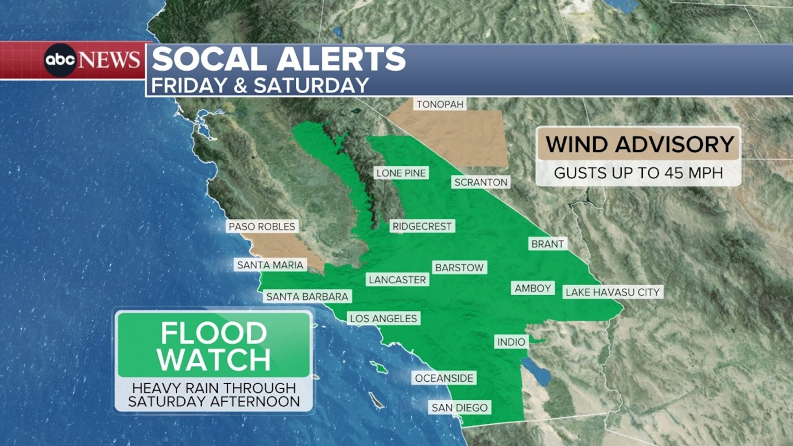
More than 22 million people in Southern California are under a flood watch as a storm on the West Coast could hit areas with burn scars, causing possible mudslides, debris flows and excessive rainfall.
Evacuation warnings are in effect through Friday night for the following burn scar areas: Canyon, Bethany, Eaton, Palisades, Hurst, Kenneth, Sunset, Lidia, Franklin and Bridge, according to Los Angeles County officials.
“Anyone in these areas should be ready to leave at a moment’s notice,” county officials said.
The storm will bring light to moderate rainfall for most of Friday, but the main flooding threat will begin Friday night into Saturday, with excessive rainfall, accompanied by lightning and some strong wind gusts, possible in some areas.

Social Alerts – Friday and Saturday Map
ABC News
As of Friday night, evacuation orders will be in effect for the following burn scar areas: Canyon, Bethany, Eaton, Palisades, Hurst, Kenneth, Sunset, Lidia, Franklin and Bridge.
According to the Los Angeles Public Workssome streets may be “completely blocked by debris” and some structures may be at risk depending on location.
These areas could see 1 inch of rain per hour, with precipitation between Friday and Saturday totaling 4 to 6 inches in the mountains of Santa Barbara, Ventura and Los Angeles counties. Rainfall totals of 2 to 4 inches are forecast across much of central and southern California, including Los Angeles, Malibu and Santa Barbara.
Areas with the strongest storms or at higher elevations could see 6 inches of rain or more.

Flash Flood Threat: Friday and Saturday Map
ABC News
There is a moderate risk of excessive rainfall and flash flooding for the Los Angeles and Santa Barbara areas, primarily due to heavier rain expected Friday night, Saturday morning and early Saturday afternoon.
There is a slight risk of excessive rainfall and flash flooding across a large swath of Southern California, with scattered areas of flash flooding possible in these areas.

Storm Tracker: Saturday at 11 a.m. Pacific Time, Map
ABC News
Heavy rain will occur mainly between 2am and 3pm local time on Saturday, which is when burn scar areas will be most at risk.
Flash flooding, landslides and the risk of debris flows will increase rapidly Friday into Saturday morning.
More rain is possible in these areas every day next week, and the threat of landslides and debris flows continues due to already saturated soil.

Storm Track: Saturday, 4:00 pm PST Map
ABC News
California Governor Gavin Newsom announced Thursday that emergency resources will be deployed ahead of the storm to protect communities in Los Angeles, Orange and Ventura counties from landslides and debris flows.
On average, Los Angeles sees 0.8 inches of rain for the entire month of November, with the record being 9.68 inches in 1965. This storm starting Friday could likely account for more than a month of November’s rain in one day for these areas.
ABC News’ Dan Peck contributed to this report.